Maine Population Density
Maine Population Density Map
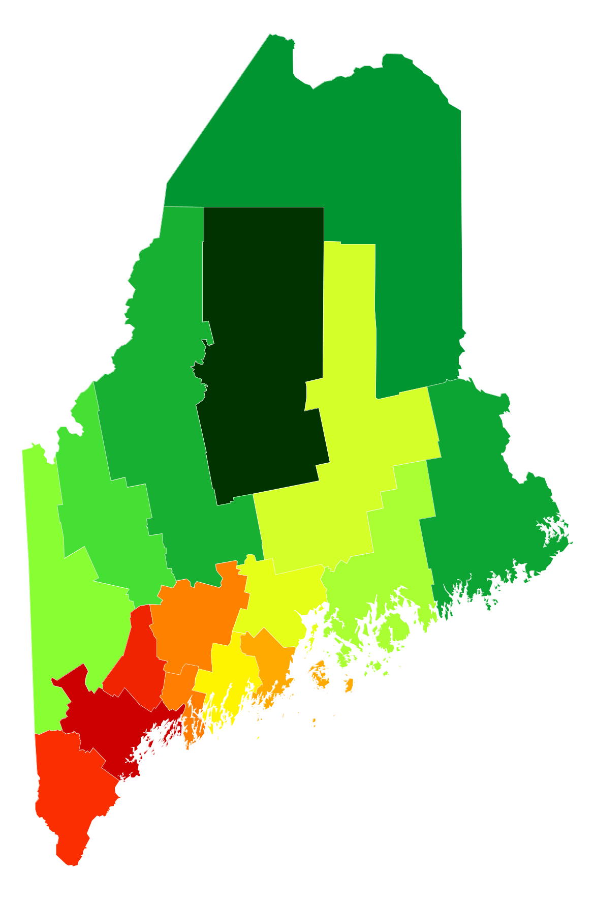
Maine Population Density by County
| County | Population Density (Population/km2) | Population | Area (km2) |
|---|---|---|---|
| Cumberland County | 120 | 285,456 | 2,388 |
| Androscoggin County | 84 | 107,604 | 1,288 |
| York County | 75 | 199,431 | 2,645 |
| Sagadahoc County | 50 | 35,013 | 698 |
| Kennebec County | 49 | 121,164 | 2,464 |
| Knox County | 40 | 39,550 | 986 |
| Lincoln County | 27 | 34,088 | 1,245 |
| Waldo County | 20 | 38,940 | 1,963 |
| Penobscot County | 17 | 153,364 | 9,221 |
| Hancock County | 12 | 54,845 | 4,407 |
| Oxford County | 10 | 57,277 | 5,638 |
| Franklin County | 6.7 | 30,495 | 4,518 |
| Somerset County | 4.9 | 51,706 | 10,613 |
| Washington County | 4.5 | 32,190 | 7,159 |
| Aroostook County | 4.0 | 70,055 | 17,696 |
| Piscataquis County | 1.5 | 17,124 | 11,341 |
Comments
© 2018 AtlasBig.com