New Hampshire Population Density
New Hampshire Population Density Map
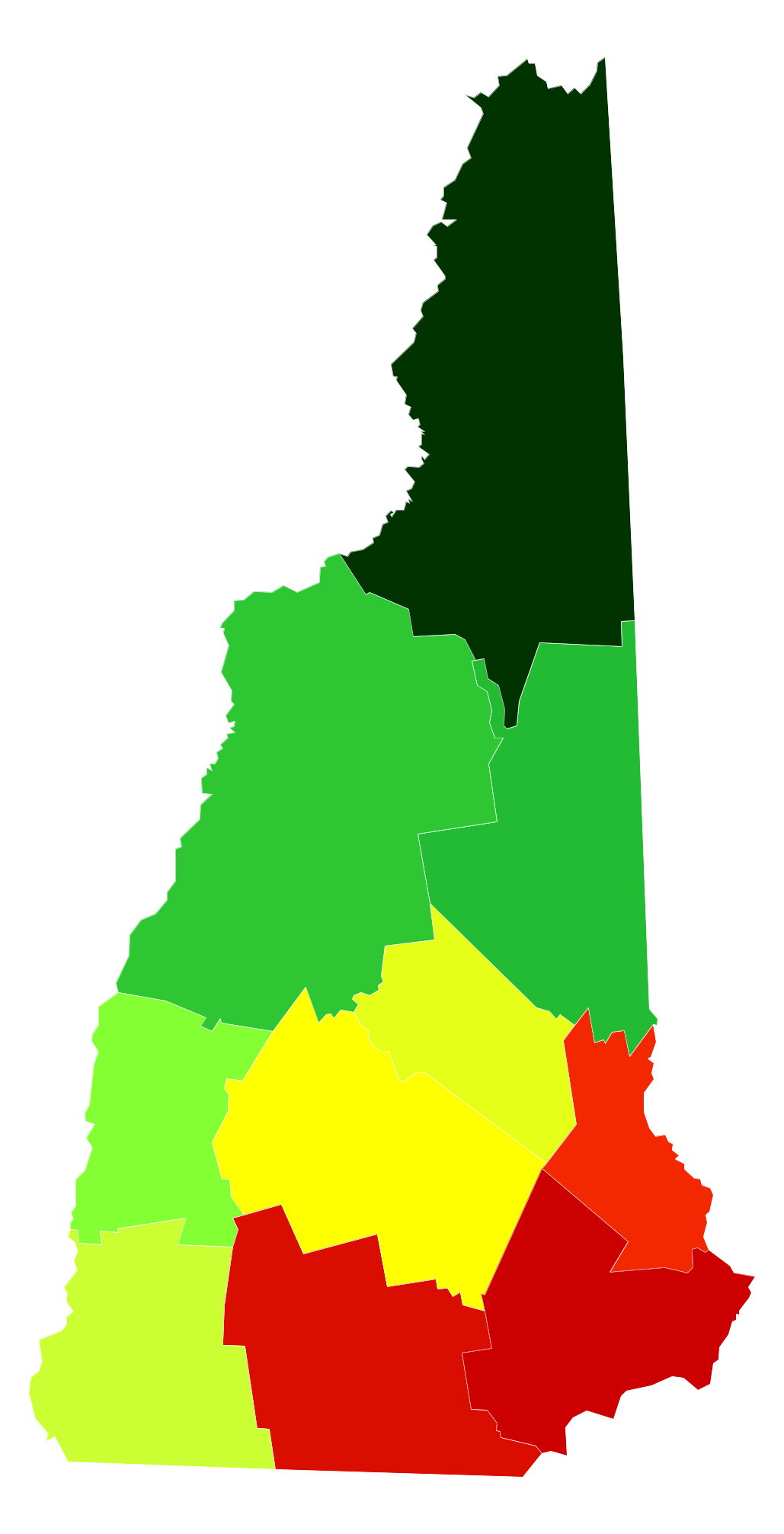
New Hampshire Population Density by County
| County | Population Density (Population/km2) | Population | Area (km2) |
|---|---|---|---|
| Hillsborough County | 175 | 403,985 | 2,311 |
| Rockingham County | 159 | 299,134 | 1,882 |
| Strafford County | 125 | 124,593 | 995 |
| Merrimack County | 59 | 146,849 | 2,479 |
| Belknap County | 50 | 60,179 | 1,214 |
| Cheshire County | 41 | 76,610 | 1,888 |
| Sullivan County | 30 | 42,984 | 1,429 |
| Grafton County | 20 | 89,629 | 4,534 |
| Carroll County | 18 | 47,499 | 2,572 |
| Coös County | 6.6 | 31,212 | 4,744 |
Comments
© 2018 AtlasBig.com