Wyoming Population Density
Wyoming Population Density Map
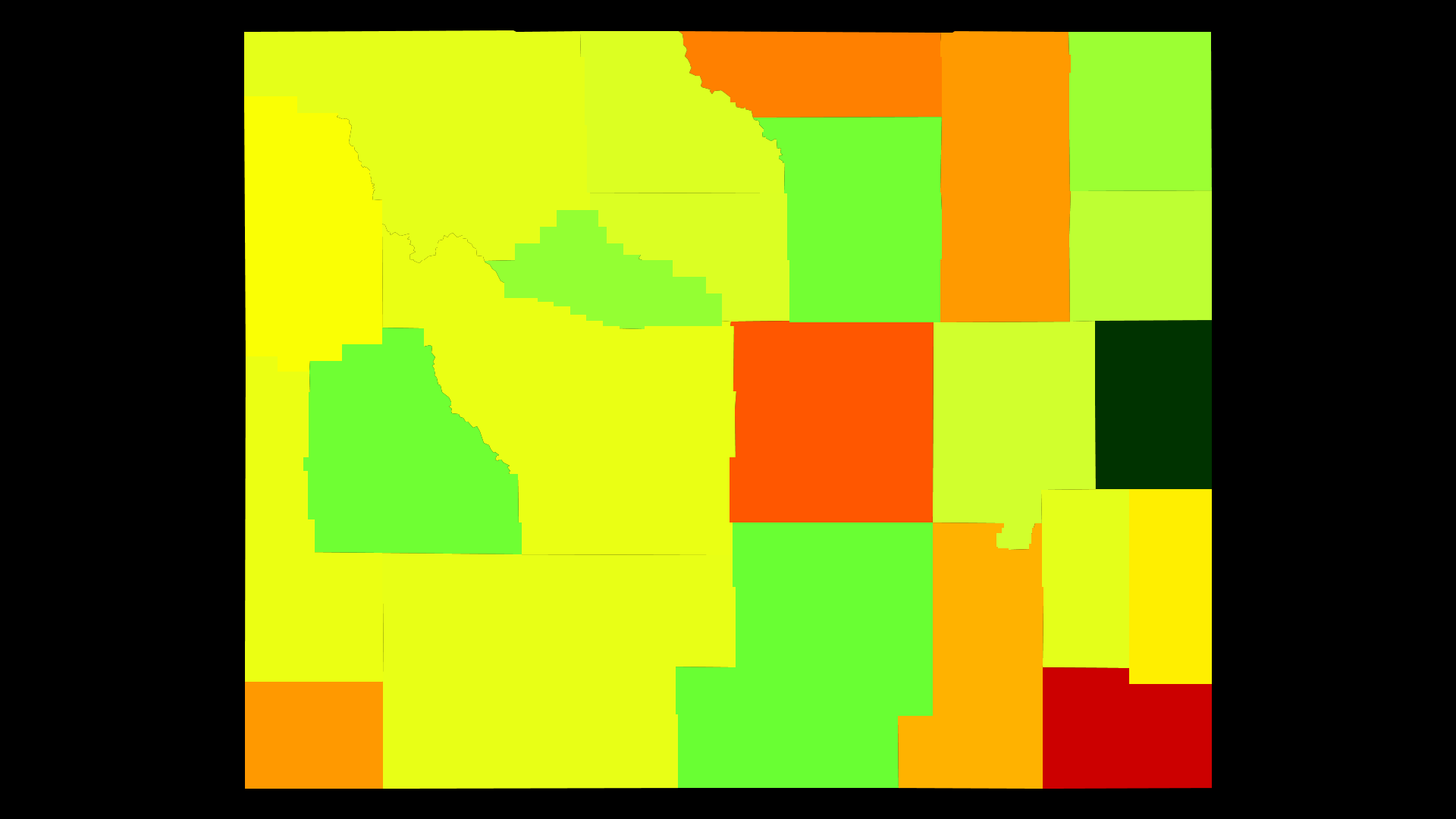
Wyoming Population Density by County
| County | Population Density (Population/km2) | Population | Area (km2) |
|---|---|---|---|
| Laramie County | 14 | 95,809 | 6,961 |
| Natrona County | 5.8 | 80,973 | 13,941 |
| Sheridan County | 4.5 | 29,824 | 6,570 |
| Uinta County | 3.9 | 21,066 | 5,411 |
| Campbell County | 3.9 | 48,176 | 12,413 |
| Albany County | 3.3 | 37,422 | 11,173 |
| Goshen County | 2.4 | 13,612 | 5,779 |
| Teton County | 2.0 | 22,268 | 10,925 |
| Lincoln County | 1.7 | 18,364 | 10,619 |
| Fremont County | 1.7 | 40,998 | 24,045 |
| Sweetwater County | 1.7 | 45,237 | 27,194 |
| Park County | 1.6 | 29,227 | 18,086 |
| Platte County | 1.6 | 8,765 | 5,478 |
| Big Horn County | 1.5 | 11,994 | 8,190 |
| Washakie County | 1.5 | 8,463 | 5,832 |
| Converse County | 1.3 | 14,313 | 11,019 |
| Weston County | 1.1 | 7,158 | 6,232 |
| Crook County | 0.97 | 7,184 | 7,423 |
| Hot Springs County | 0.93 | 4,847 | 5,190 |
| Johnson County | 0.80 | 8,628 | 10,783 |
| Sublette County | 0.79 | 10,041 | 12,782 |
| Carbon County | 0.76 | 15,748 | 20,605 |
| Niobrara County | 0.37 | 2,541 | 6,826 |
Comments
© 2018 AtlasBig.com