Zip Codes in Boston
Discover all ZIP codes in Boston, complete with an interactive map and a comprehensive table showing population, area size, and geographic boundaries for each postal code.
- We have found 32 zip codes in Boston.
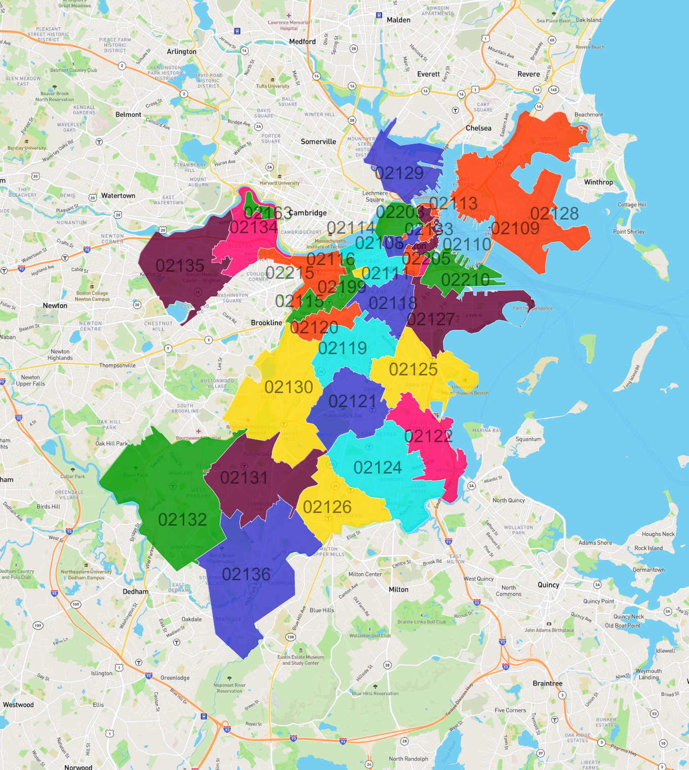
List of Zip Codes in Boston
| Zip Code | Population | Area (km2) |
|---|---|---|
| 02124 | 55,897 | 7.881 |
| 02128 | 44,124 | 13.16 |
| 02135 | 43,683 | 6.853 |
| 02130 | 41,109 | 9.493 |
| 02136 | 38,071 | 12.185 |
| 02127 | 36,646 | 5.328 |
| 02125 | 33,069 | 5.632 |
| 02131 | 31,564 | 7.24 |
| 02115 | 28,621 | 1.848 |
| 02118 | 28,522 | 2.822 |
| 02121 | 28,298 | 4.912 |
| 02132 | 27,069 | 12.848 |
| 02119 | 26,851 | 4.184 |
| 02126 | 25,313 | 4.781 |
| 02215 | 24,054 | 2.626 |
| 02122 | 23,471 | 4.455 |
| 02116 | 22,040 | 2.112 |
| 02129 | 19,994 | 4.09 |
| 02134 | 17,637 | 3.45 |
| 02120 | 15,248 | 1.604 |
| 02114 | 13,853 | 1.395 |
| 02111 | 8,067 | 0.508 |
| 02210 | 6,554 | 2.484 |
| 02113 | 6,522 | 0.252 |
| 02108 | 4,178 | 0.724 |
| 02109 | 3,714 | 0.435 |
| 02110 | 2,178 | 0.462 |
| 02163 | 1,852 | 0.475 |
| 02199 | 1,253 | 0.148 |
| 02133 | 80 | 0.034 |
| 02203 | 0 | 0.025 |
| 02205 | 0 | 0.147 |