Caribbean Netherlands
Maps and statistics of Caribbean Netherlands
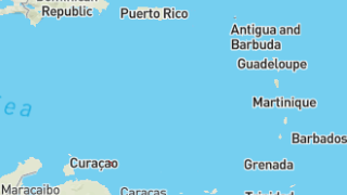
Caribisch Nederland, or the Caribbean Netherlands, consists of three special municipalities of the Netherlands: Bonaire, Sint Eustatius, and Saba. Located in the Caribbean Sea, these islands became special municipalities or "public bodies" of the Netherlands after the dissolution of the Netherlands Antilles in 2010. Each island offers unique cultural and natural attractions, contributing to a diverse experience reflective of Caribbean charm intertwined with Dutch governance.
Bonaire is renowned for its marine biodiversity, making it a premier destination for snorkeling and scuba diving enthusiasts. Its National Marine Park preserves the rich underwater life, attracting tourists keen on eco-friendly adventures.
Sint Eustatius, often referred to as Statia, is a quiet island with lush landscapes and a strong sense of history, as evidenced by restored colonial edifices and the iconic Quill volcano, a hiking favorite.
Saba, known as the "Unspoiled Queen," is famous for its dramatic topography and pristine environments, with Mount Scenery, the highest point in the Netherlands, offering breathtaking views.
Although each island operates with a degree of autonomy, they share Dutch influence in aspects like education and legal systems. Economies are generally driven by tourism, supplemented by infrastructure work and local agriculture. The islands use the US Dollar and enjoy a mix of Dutch and Caribbean cultural elements, providing a distinct lifestyle.
| Population | 25,987 |
|---|---|
| Area | 312.955 km2 |
