Zip Codes in Denver
Discover all ZIP codes in Denver, complete with an interactive map and a comprehensive table showing population, area size, and geographic boundaries for each postal code.
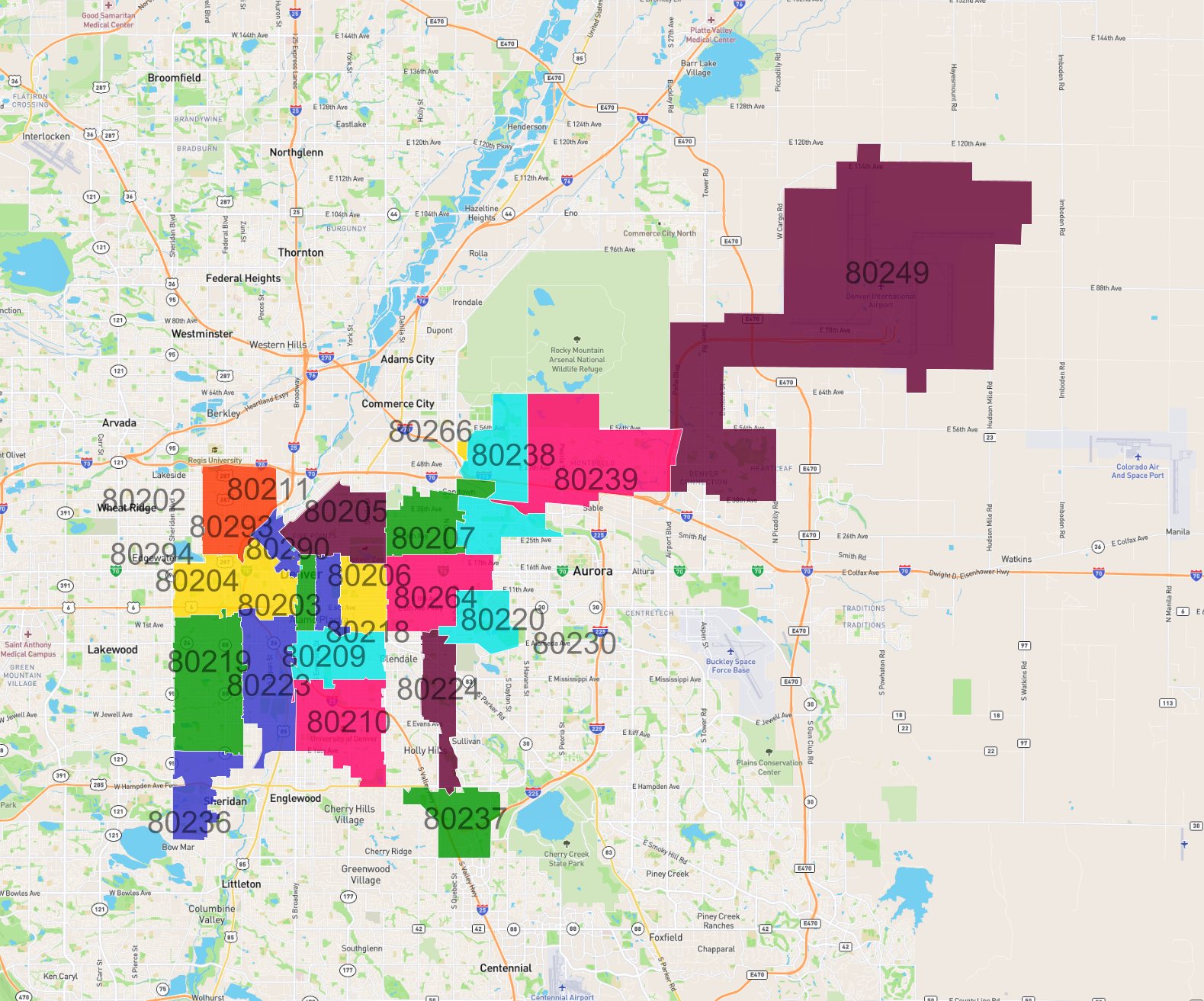
- We have found 25 zip codes in Denver.
List of Zip Codes in Denver
| Zip Code | Population | Area (km2) |
|---|---|---|
| 80219 | 60,095 | 19.338 |
| 80239 | 44,077 | 26.847 |
| 80249 | 41,209 | 123.538 |
| 80210 | 39,155 | 15.823 |
| 80211 | 37,441 | 11.79 |
| 80220 | 36,311 | 13.394 |
| 80204 | 35,518 | 14.198 |
| 80205 | 33,856 | 12.131 |
| 80238 | 29,448 | 17.627 |
| 80209 | 26,794 | 9.128 |
| 80206 | 24,555 | 6.418 |
| 80237 | 22,764 | 9.404 |
| 80207 | 22,382 | 10.153 |
| 80203 | 22,355 | 2.831 |
| 80223 | 19,624 | 13.805 |
| 80218 | 19,364 | 4.1 |
| 80224 | 19,265 | 8.493 |
| 80202 | 18,233 | 2.995 |
| 80236 | 17,207 | 8.321 |
| 80230 | 10,811 | 7.136 |
| 80290 | 452 | 0.019 |
| 80294 | 0 | 0.031 |
| 80264 | 0 | 0.019 |
| 80266 | 0 | 0.361 |
| 80293 | 0 | 0.008 |