Zip Codes in El Paso
Discover all ZIP codes in El Paso, complete with an interactive map and a comprehensive table showing population, area size, and geographic boundaries for each postal code.
- We have found 15 zip codes in El Paso.
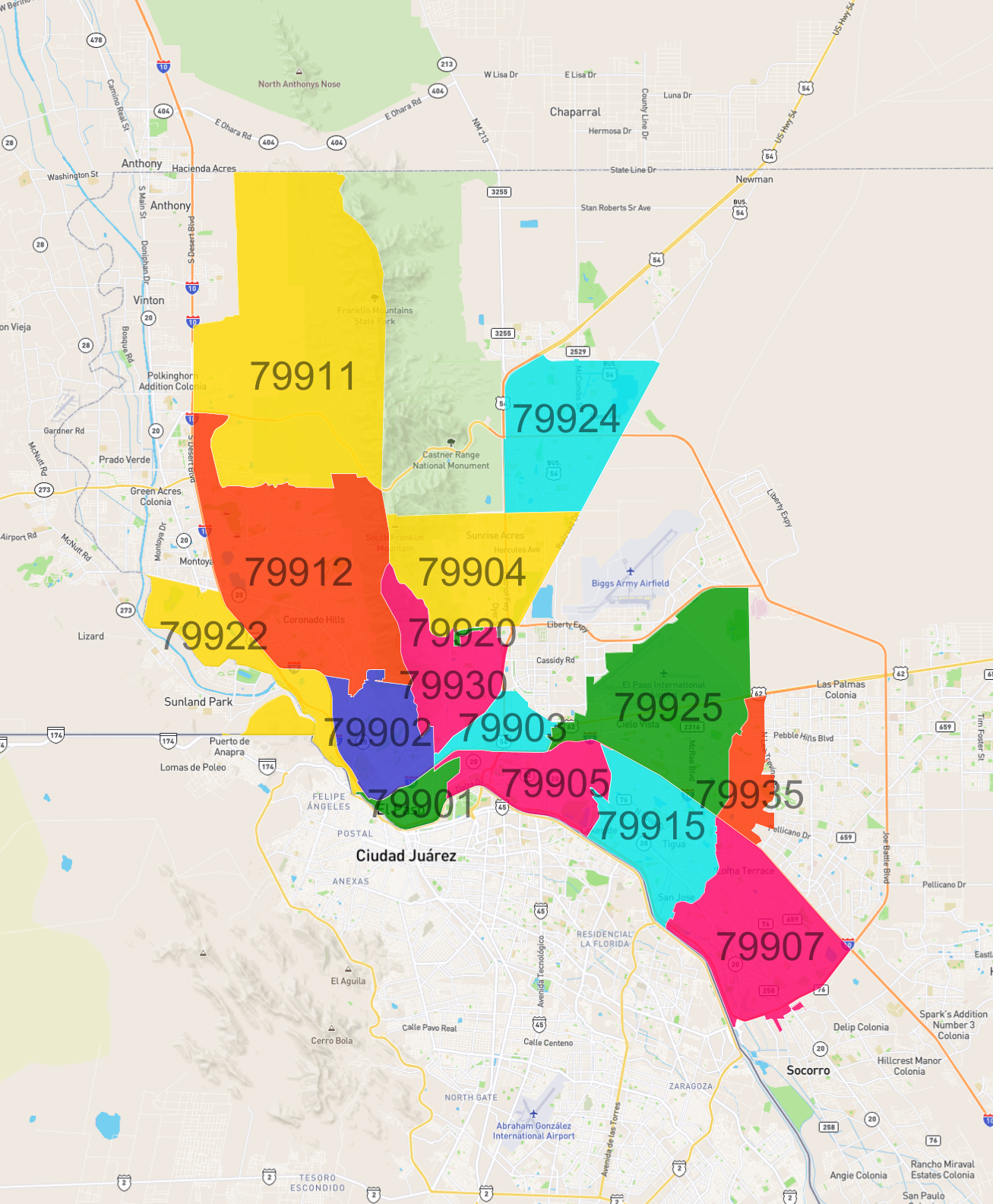
List of Zip Codes in El Paso
| Zip Code | Population | Area (km2) |
|---|---|---|
| 79912 | 79,126 | 61.413 |
| 79924 | 60,399 | 32.072 |
| 79907 | 47,850 | 35.593 |
| 79925 | 40,241 | 45.246 |
| 79915 | 34,731 | 23.26 |
| 79904 | 33,022 | 30.96 |
| 79930 | 25,484 | 19.438 |
| 79905 | 22,062 | 17.319 |
| 79935 | 19,073 | 8.978 |
| 79902 | 18,529 | 16.948 |
| 79903 | 15,120 | 7.899 |
| 79911 | 9,107 | 89.348 |
| 79901 | 8,321 | 5.728 |
| 79922 | 7,162 | 21.082 |
| 79920 | 28 | 0.356 |