Zip Codes in Fort Worth
Discover all ZIP codes in Fort Worth, complete with an interactive map and a comprehensive table showing population, area size, and geographic boundaries for each postal code.
- We have found 19 zip codes in Fort Worth.
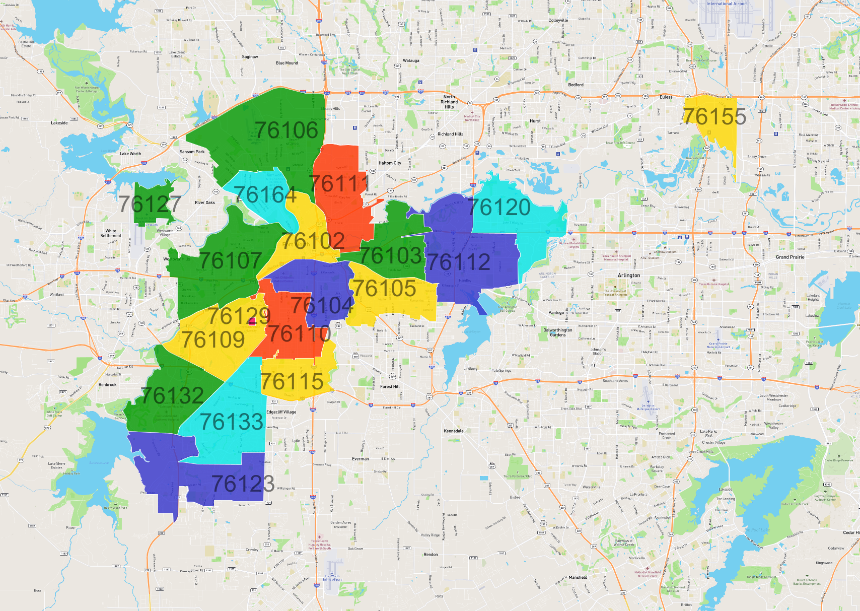
List of Zip Codes in Fort Worth
| Zip Code | Population | Area (km2) |
|---|---|---|
| 76133 | 53,825 | 24.166 |
| 76112 | 44,379 | 30.175 |
| 76123 | 42,777 | 27.472 |
| 76106 | 36,374 | 37.792 |
| 76110 | 32,089 | 14.96 |
| 76107 | 31,112 | 27.992 |
| 76132 | 26,432 | 19.272 |
| 76109 | 26,000 | 21.273 |
| 76105 | 22,550 | 15.264 |
| 76115 | 21,044 | 12.035 |
| 76111 | 20,823 | 19.467 |
| 76104 | 20,694 | 15.208 |
| 76120 | 20,031 | 19.439 |
| 76103 | 16,769 | 15.91 |
| 76164 | 13,134 | 10.453 |
| 76102 | 11,783 | 11.89 |
| 76155 | 6,301 | 9.13 |
| 76127 | 1,839 | 5.612 |
| 76129 | 1,722 | 0.215 |