Gelderland
Maps and statistics of Gelderland
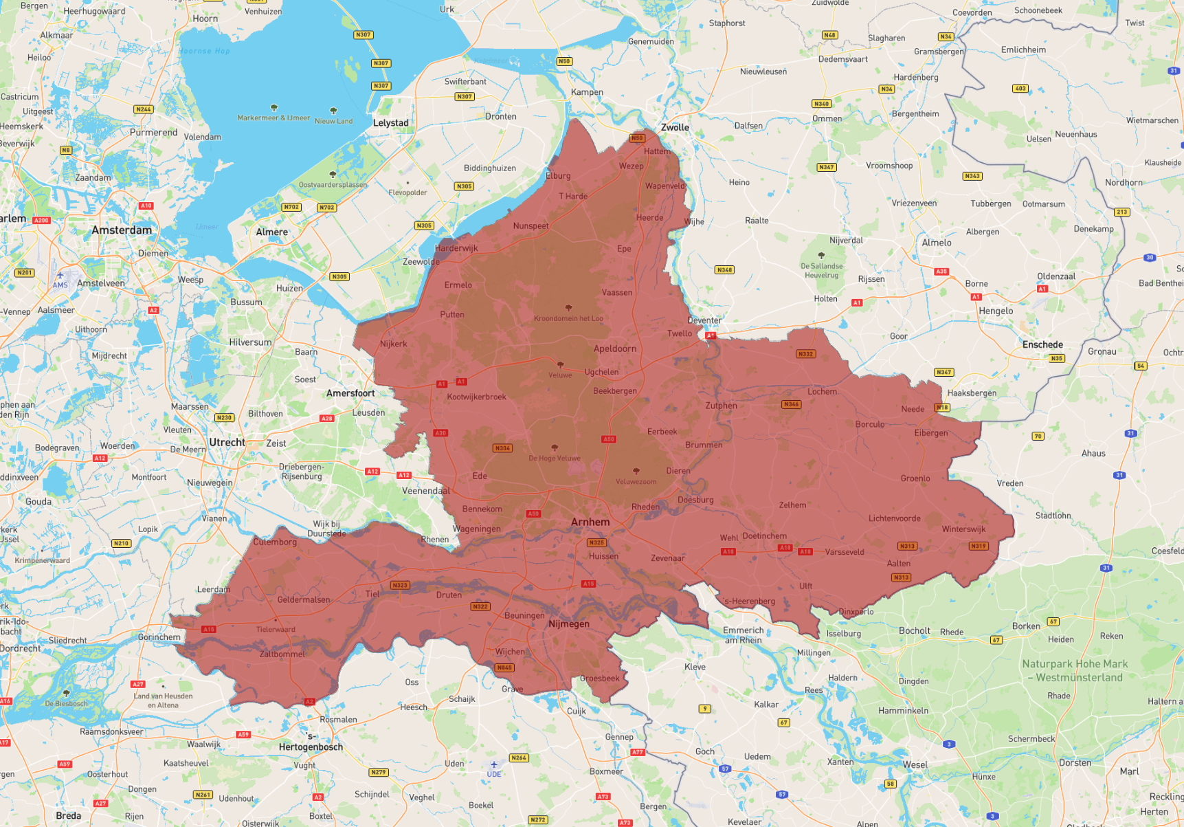
Gelderland is a province in the eastern part of the Netherlands, known for its diverse landscapes, rich history, and cultural heritage. It is the largest province in the country by land area and is bordered by the provinces of Utrecht, South Holland, North Brabant, Limburg, Overijssel, and Flevoland, as well as Germany to the east. Arnhem serves as the capital of Gelderland and is renowned for its parks and the John Frost Bridge, a site of the World War II Battle of Arnhem. Another major city is Nijmegen, one of the oldest cities in the Netherlands, celebrated for its vibrant student population and annual Four Days Marches, a walking event attracting participants worldwide.
Gelderland features diverse landscapes, from the Veluwe, a region with extensive forests and heathlands, to the river areas of the Rhine, Waal, and IJssel, which are vital for trade and transport. The province is rich in castles, historic estates, and museums, such as the Kröller-Müller Museum in the Hoge Veluwe National Park, housing works by Vincent van Gogh. Agriculture, forestry, and logistics are key economic activities, with a growing focus on sustainable development and tourism.
| Population | 2,085,952 |
|---|---|
| Area | 5,139.246 km2 |