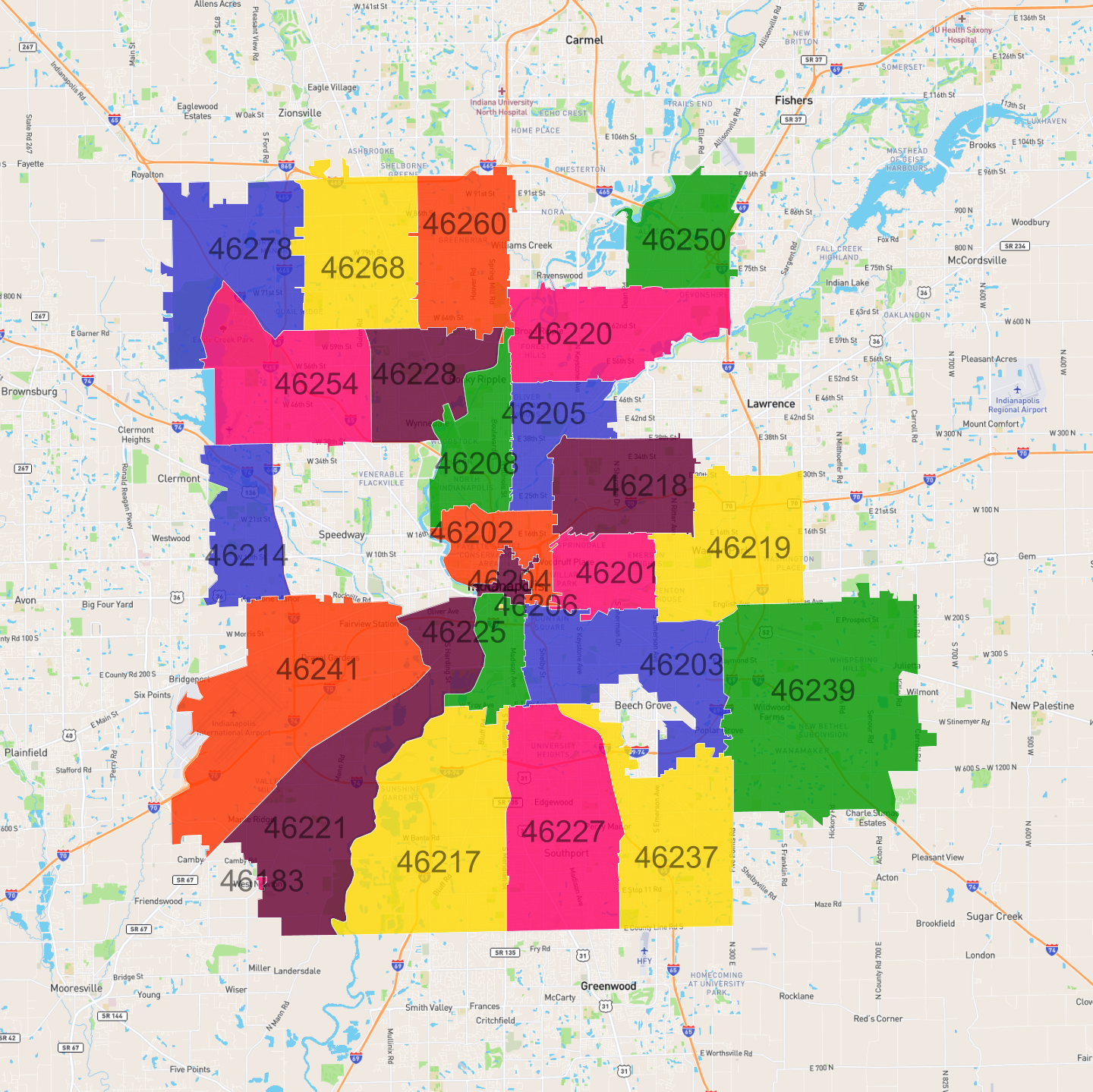
Zip Codes in Indianapolis
Discover all ZIP codes in Indianapolis, complete with an interactive map and a comprehensive table showing population, area size, and geographic boundaries for each postal code.
- We have found 25 zip codes in Indianapolis.
List of Zip Codes in Indianapolis
| Zip Code | Population | Area (km2) |
|---|---|---|
| 46227 | 57,164 | 43.261 |
| 46237 | 42,747 | 38.036 |
| 46254 | 40,263 | 36.427 |
| 46217 | 38,659 | 55.085 |
| 46219 | 38,246 | 33.788 |
| 46203 | 37,297 | 36.108 |
| 46220 | 36,159 | 31.65 |
| 46260 | 35,102 | 26.995 |
| 46239 | 33,403 | 73.337 |
| 46241 | 32,943 | 62.162 |
| 46201 | 31,650 | 14.465 |
| 46205 | 29,196 | 16.269 |
| 46218 | 28,560 | 24.709 |
| 46221 | 26,255 | 52.609 |
| 46268 | 25,623 | 32.943 |
| 46214 | 24,645 | 19.858 |
| 46208 | 22,026 | 18.34 |
| 46202 | 20,331 | 14.423 |
| 46250 | 17,933 | 20.118 |
| 46228 | 16,324 | 20.666 |
| 46204 | 11,022 | 2.967 |
| 46278 | 8,733 | 34.62 |
| 46225 | 5,535 | 10.704 |
| 46183 | 41 | 0.182 |
| 46206 | 0 | 0.043 |