Zip Codes in Jacksonville
Discover all ZIP codes in Jacksonville, complete with an interactive map and a comprehensive table showing population, area size, and geographic boundaries for each postal code.
- We have found 32 zip codes in Jacksonville.
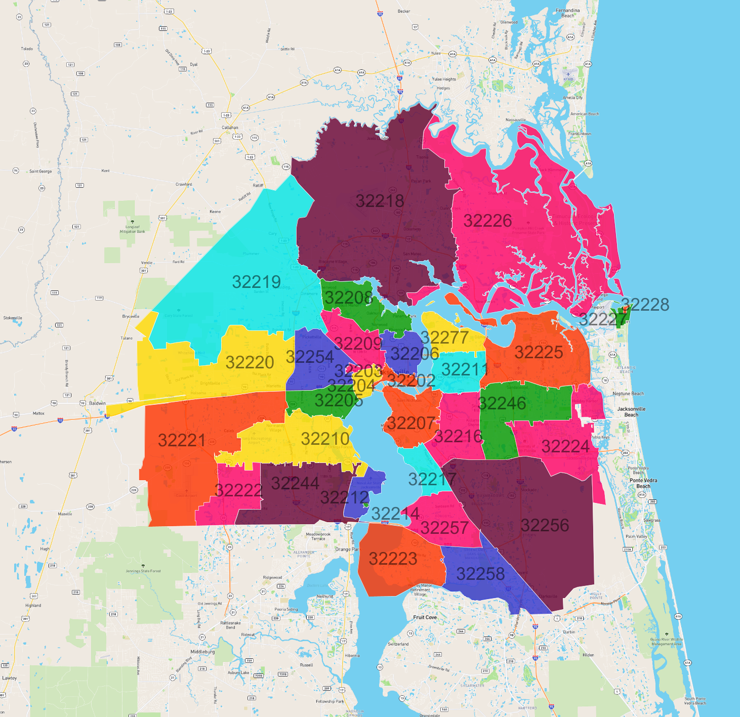
List of Zip Codes in Jacksonville
| Zip Code | Population | Area (km2) |
|---|---|---|
| 32218 | 71,066 | 254.679 |
| 32210 | 65,626 | 60.543 |
| 32244 | 63,352 | 62.378 |
| 32246 | 60,443 | 50.313 |
| 32256 | 55,510 | 160.497 |
| 32225 | 54,591 | 71.492 |
| 32224 | 42,252 | 56.307 |
| 32257 | 41,791 | 32.604 |
| 32216 | 41,323 | 33.974 |
| 32258 | 40,545 | 47.494 |
| 32211 | 36,253 | 22.15 |
| 32209 | 35,490 | 24.189 |
| 32207 | 35,320 | 30.299 |
| 32277 | 35,310 | 18.831 |
| 32221 | 31,234 | 123.532 |
| 32208 | 31,093 | 30.9 |
| 32205 | 30,162 | 20.09 |
| 32223 | 26,079 | 54.252 |
| 32217 | 21,084 | 14.198 |
| 32226 | 20,396 | 238.179 |
| 32222 | 17,806 | 29.639 |
| 32206 | 16,809 | 16.287 |
| 32219 | 15,617 | 186.371 |
| 32254 | 14,653 | 32.204 |
| 32220 | 12,556 | 101.488 |
| 32204 | 8,421 | 7.021 |
| 32202 | 6,550 | 5.168 |
| 32227 | 3,365 | 3.038 |
| 32212 | 1,709 | 13.397 |
| 32228 | 203 | 0.335 |
| 32214 | 0 | 0.231 |
| 32203 | 0 | 0.108 |