Neighbourhoods in Louisville
List and Map of the Neighbourhoods in Louisville
- We have found 88 neighbourhoods in Louisville.
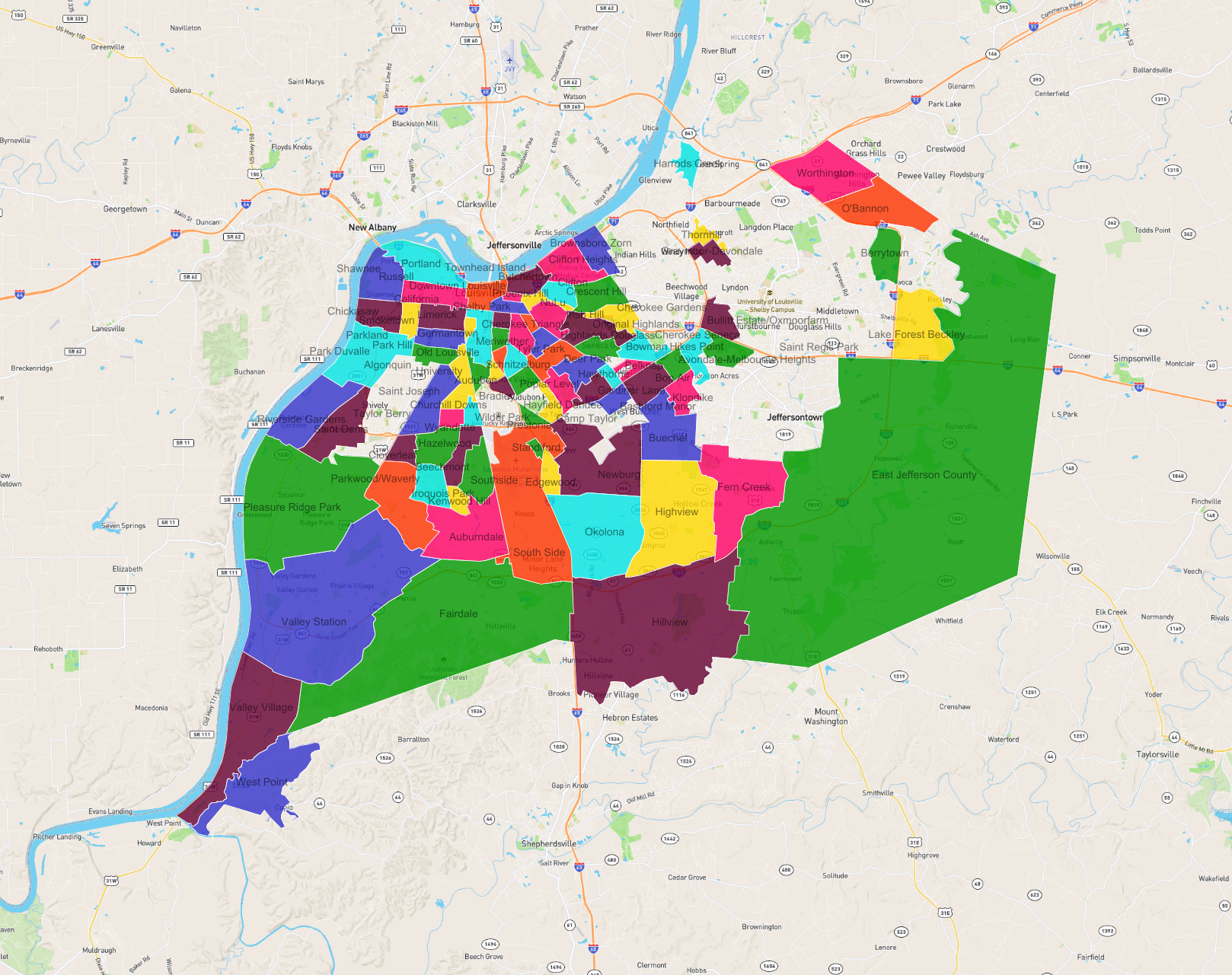
List of the Neighbourhoods in Louisville
| Neighbourhood |
|---|
| NuLu |
| Thornhill |
| Hillview |
| Shelby Park |
| Hazelwood |
| Newburg |
| Beechmont |
| Saint Joseph |
| Lake Forest Beckley |
| Poplar Level |
| Fairdale |
| Hikes Point |
| Deer Park |
| Crescent Hill |
| Bradley |
| Avondale-Melbourne Heights |
| Old Louisville |
| Southside |
| Saint Denis |
| Meriwether |
| Hawthorne |
| West Point |
| Audubon |
| Downtown Louisville |
| Irish Hill |
| Riverside Gardens |
| Cherokee Triangle |
| South Side |
| Iroquois Park |
| East Jefferson County |
| Taylor Berry |
| Chickasaw |
| O'Bannon |
| Hayfield Dundee |
| Bon Air |
| Highview |
| Phoenix Hill |
| Park Duvalle |
| Bowman |
| Okolona |
| Wilder Park |
| Germantown |
| Schnitzelburg |
| Camp Taylor |
| Smoketown |
| Cloverleaf |
| Harrods Creek |
| Valley Station |
| Russell |
| Churchill Downs |
| Bashford Manor |
| Limerick |
| Parkwood/Waverly |
| Klondike |
| Kenwood Hill |
| Brownsboro Zorn |
| Prestonia |
| Edgewood |
| Belknap |
| Berrytown |
| Original Highlands |
| Valley Village |
| Townhead Island |
| Parkland |
| Clifton Heights |
| University |
| Park Hill |
| Butchertown |
| Wyandotte |
| Pleasure Ridge Park |
| Fern Creek |
| Portland |
| Gardiner Lane |
| Bullitt Estate/Oxmoorfarm |
| Saint Regis Park |
| Graymoor-Devondale |
| Worthington |
| Clifton |
| Standiford |
| Shawnee |
| Tyler Park |
| Auburndale |
| Cherokee Seneca |
| Cherokee Gardens |
| California |
| Buechel |
| Algonquin |
| Highlands Douglass |