Zip Codes in Louisville
Discover all ZIP codes in Louisville, complete with an interactive map and a comprehensive table showing population, area size, and geographic boundaries for each postal code.
- We have found 24 zip codes in Louisville.
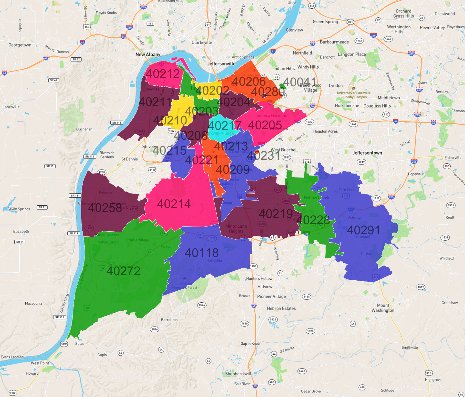
List of Zip Codes in Louisville
| Zip Code | Population | Area (km2) |
|---|---|---|
| 40214 | 45,986 | 38.958 |
| 40291 | 41,506 | 59.42 |
| 40219 | 39,107 | 38.776 |
| 40272 | 37,595 | 87.331 |
| 40258 | 26,590 | 30.461 |
| 40205 | 24,335 | 17.948 |
| 40211 | 21,165 | 19.097 |
| 40206 | 20,345 | 15.274 |
| 40215 | 19,444 | 9.065 |
| 40228 | 18,491 | 22.596 |
| 40203 | 17,540 | 7.5 |
| 40213 | 15,805 | 24.933 |
| 40208 | 15,287 | 6.76 |
| 40212 | 15,160 | 9.932 |
| 40210 | 14,226 | 8.223 |
| 40204 | 14,018 | 8.334 |
| 40217 | 11,831 | 6.217 |
| 40118 | 9,903 | 39.238 |
| 40202 | 7,109 | 4.183 |
| 40209 | 571 | 11.203 |
| 40041 | 518 | 0.337 |
| 40280 | 193 | 0.183 |
| 40221 | 0 | 0.373 |
| 40231 | 0 | 0.174 |