Zip Codes in Minneapolis
Discover all ZIP codes in Minneapolis, complete with an interactive map and a comprehensive table showing population, area size, and geographic boundaries for each postal code.
- We have found 18 zip codes in Minneapolis.
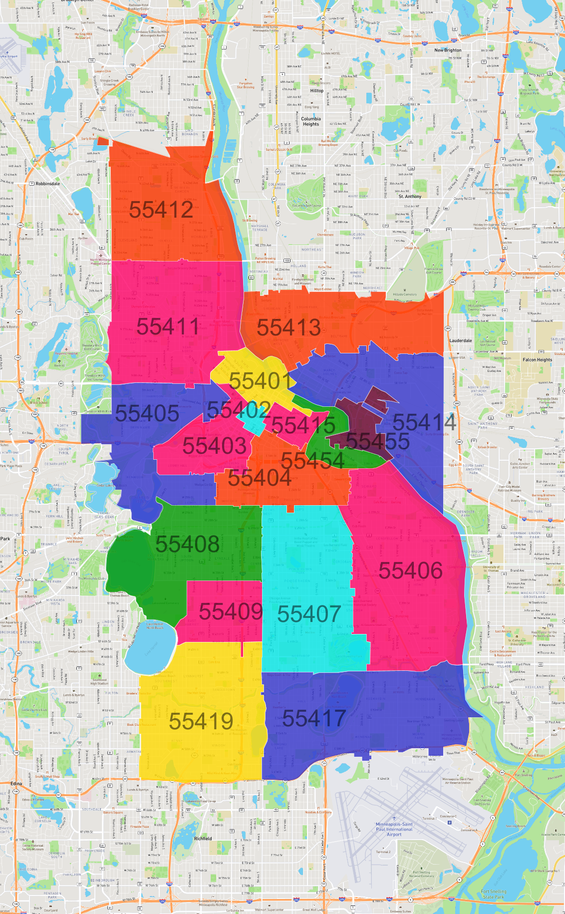
List of Zip Codes in Minneapolis
| Zip Code | Population | Area (km2) |
|---|---|---|
| 55407 | 36,992 | 10.66 |
| 55406 | 35,863 | 13.755 |
| 55414 | 33,739 | 8.467 |
| 55408 | 32,534 | 8.692 |
| 55419 | 29,728 | 11.167 |
| 55411 | 29,719 | 10.592 |
| 55404 | 28,071 | 4.677 |
| 55412 | 26,182 | 9.074 |
| 55417 | 25,677 | 12.477 |
| 55403 | 17,354 | 3.56 |
| 55405 | 16,915 | 7.85 |
| 55413 | 14,328 | 8.408 |
| 55401 | 11,526 | 2.348 |
| 55409 | 11,405 | 3.389 |
| 55454 | 8,628 | 1.708 |
| 55415 | 6,474 | 1.135 |
| 55455 | 5,243 | 1.657 |
| 55402 | 760 | 0.437 |