Zip Codes in New Orleans
Discover all ZIP codes in New Orleans, complete with an interactive map and a comprehensive table showing population, area size, and geographic boundaries for each postal code.
- We have found 20 zip codes in New Orleans.
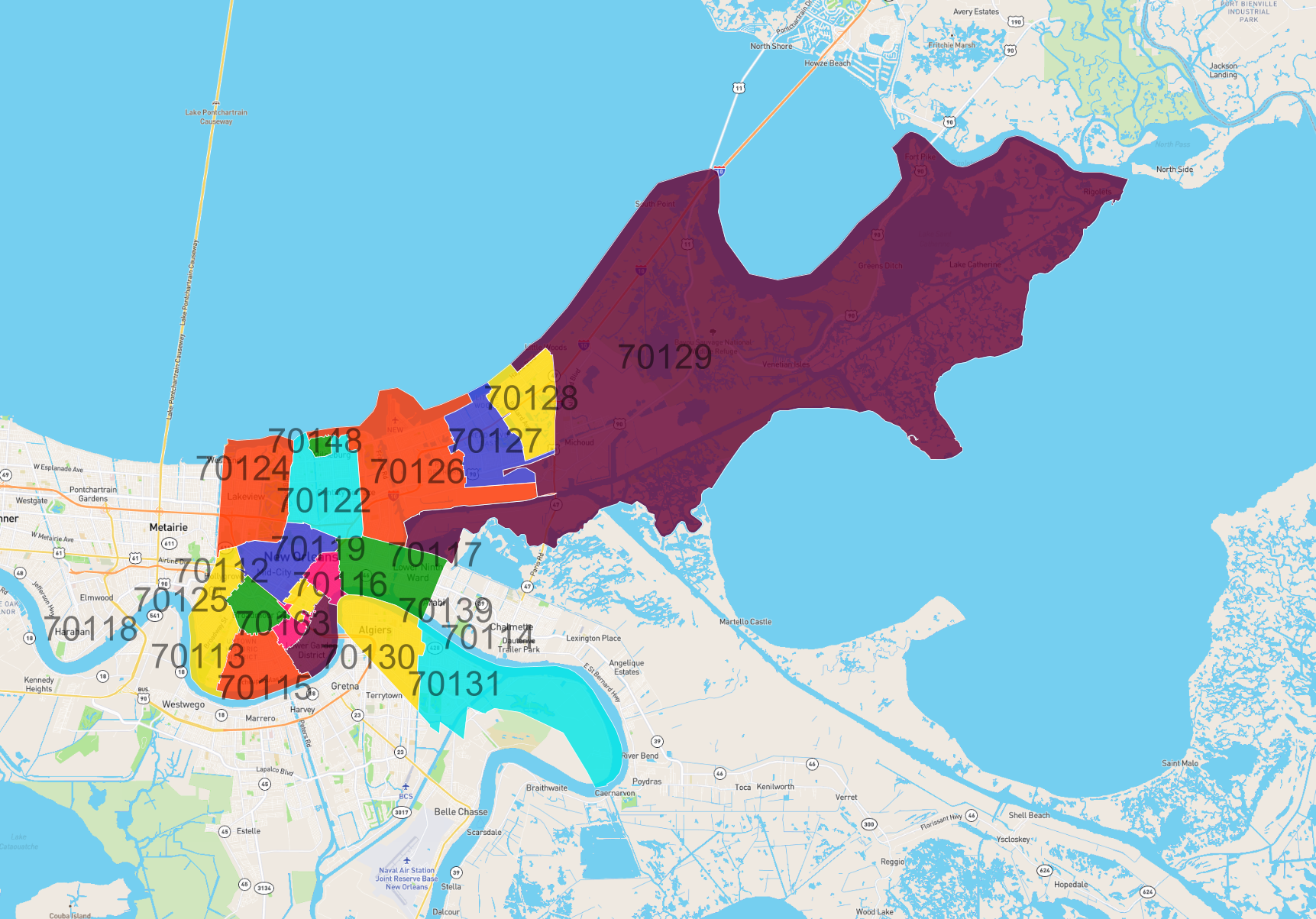
List of Zip Codes in New Orleans
| Zip Code | Population | Area (km2) |
|---|---|---|
| 70119 | 36,167 | 11.791 |
| 70118 | 36,061 | 13.761 |
| 70122 | 35,318 | 16.816 |
| 70115 | 31,737 | 11.455 |
| 70126 | 28,690 | 39.434 |
| 70117 | 26,250 | 16.272 |
| 70131 | 25,460 | 38.24 |
| 70127 | 24,769 | 14.818 |
| 70128 | 22,973 | 13.628 |
| 70114 | 22,132 | 15.028 |
| 70124 | 20,840 | 19.988 |
| 70125 | 18,422 | 6.065 |
| 70130 | 12,883 | 6.743 |
| 70116 | 10,377 | 3.607 |
| 70129 | 10,219 | 345.411 |
| 70113 | 9,888 | 2.371 |
| 70112 | 3,646 | 2.545 |
| 70148 | 203 | 1.108 |
| 70139 | 0 | 0.013 |
| 70163 | 0 | 0.009 |