Zip Codes in Oklahoma City
Discover all ZIP codes in Oklahoma City, complete with an interactive map and a comprehensive table showing population, area size, and geographic boundaries for each postal code.
- We have found 33 zip codes in Oklahoma City.
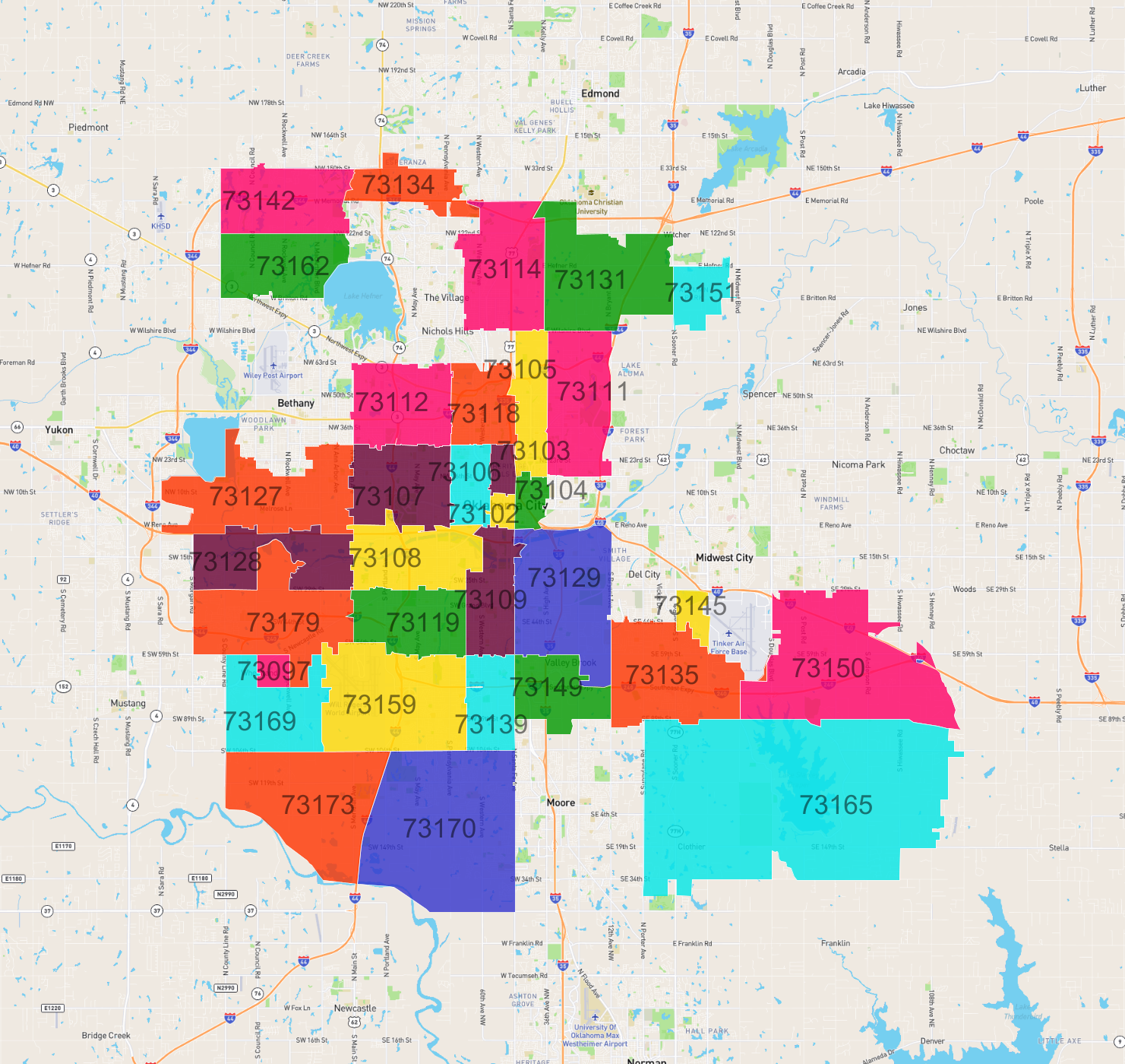
List of Zip Codes in Oklahoma City
| Zip Code | Population | Area (km2) |
|---|---|---|
| 73170 | 41,746 | 55.451 |
| 73159 | 32,172 | 35.631 |
| 73112 | 30,422 | 19.85 |
| 73119 | 30,307 | 17.621 |
| 73162 | 28,610 | 18.663 |
| 73127 | 26,830 | 30.648 |
| 73107 | 25,995 | 19.616 |
| 73135 | 22,206 | 28.476 |
| 73109 | 20,904 | 13.996 |
| 73129 | 19,730 | 32.48 |
| 73114 | 18,235 | 24.644 |
| 73139 | 18,084 | 11.412 |
| 73142 | 16,364 | 20.608 |
| 73108 | 15,239 | 19.789 |
| 73118 | 14,118 | 12.551 |
| 73106 | 13,019 | 7.867 |
| 73111 | 11,216 | 22.415 |
| 73165 | 8,226 | 117.032 |
| 73179 | 7,502 | 30.596 |
| 73128 | 7,011 | 19.079 |
| 73134 | 6,874 | 11.353 |
| 73149 | 6,043 | 14.031 |
| 73105 | 5,810 | 11.653 |
| 73150 | 5,701 | 48.712 |
| 73103 | 5,354 | 3.045 |
| 73173 | 4,529 | 35.725 |
| 73104 | 3,746 | 4.065 |
| 73145 | 3,685 | 3.557 |
| 73102 | 3,590 | 2.066 |
| 73169 | 3,432 | 19.445 |
| 73131 | 3,427 | 31.247 |
| 73151 | 2,145 | 7.773 |
| 73097 | 179 | 2.568 |