Neighbourhoods in Portland
List and Map of the Neighbourhoods in Portland
- We have found 95 neighbourhoods in Portland.
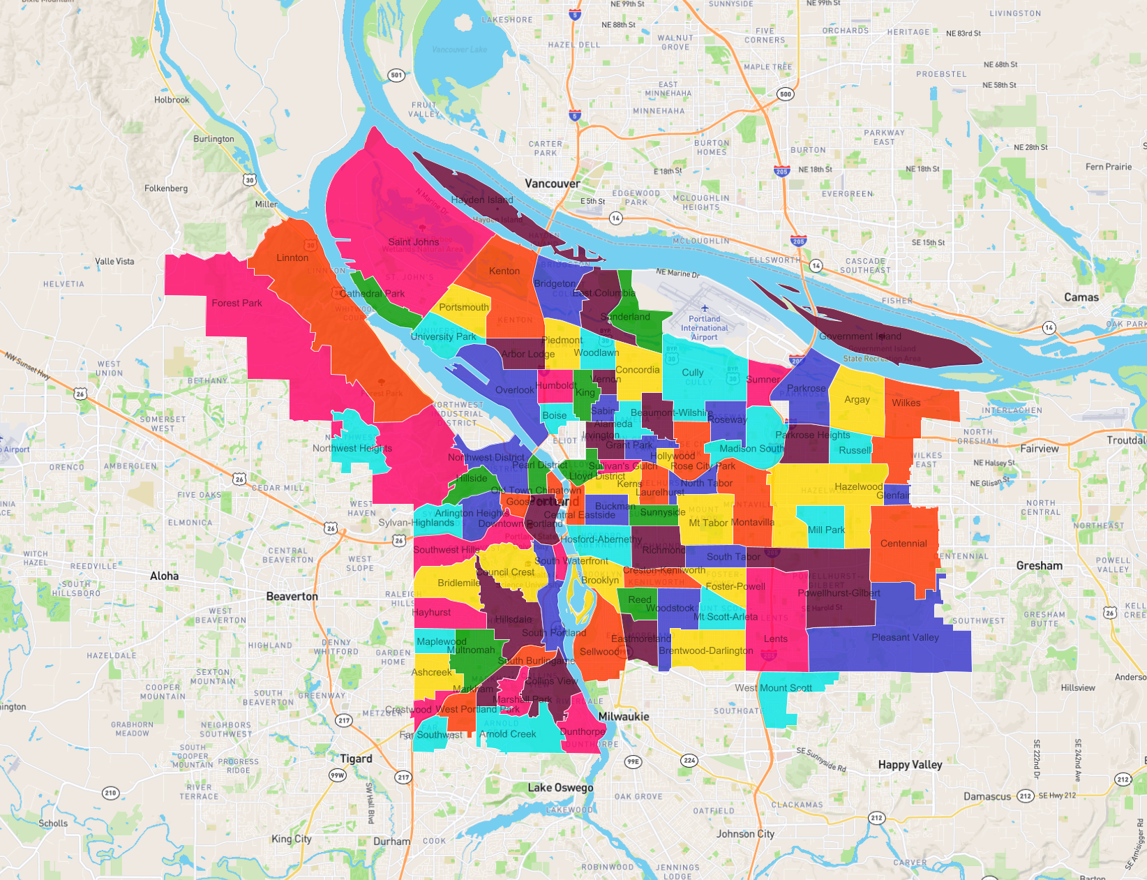
List of the Neighbourhoods in Portland
| Neighbourhood |
|---|
| South Waterfront |
| West Portland Park |
| Hillside |
| Sullivan's Gulch |
| Arnold Creek |
| Multnomah |
| Sylvan-Highlands |
| Northwest Heights |
| Glenfair |
| Creston-Kenilworth |
| Centennial |
| Overlook |
| Lents |
| Woodstock |
| East Columbia |
| Cully |
| Northwest District |
| Ashcreek |
| Woodlawn |
| Laurelhurst |
| Sabin |
| Hillsdale |
| Eastmoreland |
| Saint Johns |
| King |
| Humboldt |
| Sellwood |
| Collins View |
| Beaumont-Wilshire |
| Wilkes |
| Parkrose Heights |
| Cathedral Park |
| Boise |
| Sunderland |
| Dunthorpe |
| Pleasant Valley |
| Hazelwood |
| Kenton |
| Old Town Chinatown |
| Madison South |
| Richmond |
| Maplewood |
| Sunnyside |
| Piedmont |
| Portsmouth |
| Sumner |
| Goose Hollow |
| Bridlemile |
| Lloyd District |
| Russell |
| Montavilla |
| Pearl District |
| Mt Tabor |
| Roseway |
| University Park |
| Brooklyn |
| Government Island |
| Grant Park |
| South Burlingame |
| Kerns |
| Council Crest |
| Brentwood-Darlington |
| Rose City Park |
| Buckman |
| Hosford-Abernethy |
| Alameda |
| Linnton |
| Powellhurst-Gilbert |
| Arbor Lodge |
| Central Eastside |
| Crestwood |
| Hayden Island |
| South Tabor |
| Reed |
| Irvington |
| Arlington Heights |
| Vernon |
| North Tabor |
| Marshall Park |
| Argay |
| Foster-Powell |
| Hayhurst |
| Markham |
| South Portland |
| Mt Scott-Arleta |
| Downtown Portland |
| West Mount Scott |
| Southwest Hills |
| Concordia |
| Forest Park |
| Mill Park |
| Hollywood |
| Parkrose |
| Far Southwest |
| Bridgeton |