Zip Codes in San Antonio
Discover all ZIP codes in San Antonio, complete with an interactive map and a comprehensive table showing population, area size, and geographic boundaries for each postal code.
- We have found 34 zip codes in San Antonio.
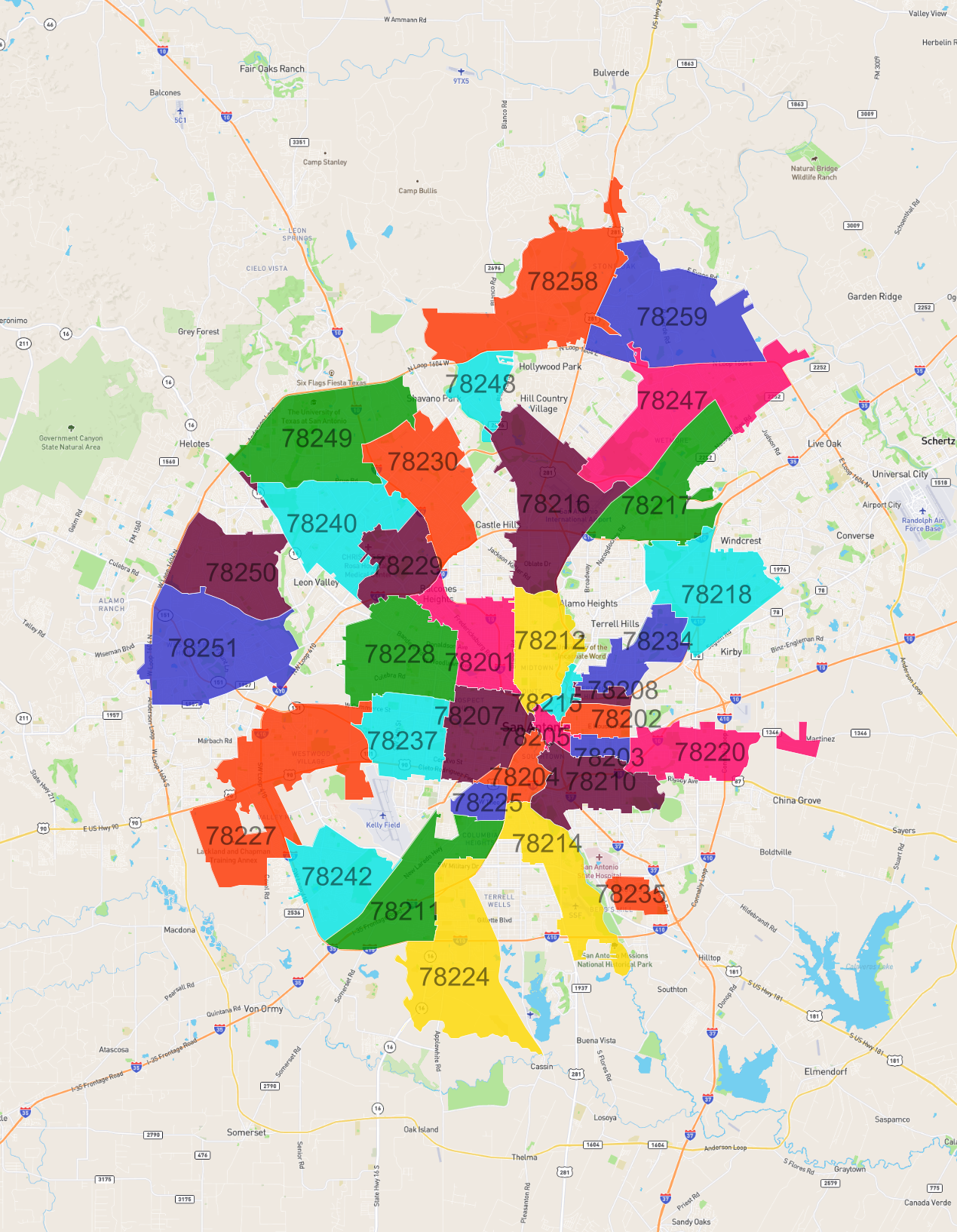
List of Zip Codes in San Antonio
| Zip Code | Population | Area (km2) |
|---|---|---|
| 78249 | 61,772 | 37.603 |
| 78251 | 61,683 | 38.89 |
| 78250 | 57,849 | 24.403 |
| 78240 | 57,014 | 28.961 |
| 78228 | 55,474 | 28.423 |
| 78207 | 54,128 | 19.436 |
| 78247 | 51,979 | 37.814 |
| 78258 | 51,672 | 45.107 |
| 78227 | 44,091 | 49.587 |
| 78201 | 43,426 | 18.711 |
| 78230 | 42,070 | 27.205 |
| 78216 | 42,044 | 36.585 |
| 78218 | 38,291 | 28.996 |
| 78237 | 36,930 | 18.511 |
| 78242 | 35,976 | 20.583 |
| 78229 | 35,195 | 14.999 |
| 78210 | 34,740 | 19.055 |
| 78217 | 33,959 | 26.528 |
| 78211 | 30,589 | 26.52 |
| 78259 | 26,931 | 40.262 |
| 78212 | 26,670 | 17.953 |
| 78214 | 21,884 | 21.73 |
| 78224 | 20,671 | 39.753 |
| 78220 | 18,497 | 20.046 |
| 78248 | 14,127 | 9.989 |
| 78225 | 13,188 | 4.995 |
| 78204 | 11,944 | 7.23 |
| 78202 | 9,952 | 5.975 |
| 78234 | 6,281 | 13.188 |
| 78203 | 4,845 | 3.54 |
| 78208 | 3,877 | 2.531 |
| 78215 | 3,258 | 2.752 |
| 78235 | 2,440 | 4.943 |
| 78205 | 1,653 | 3.044 |