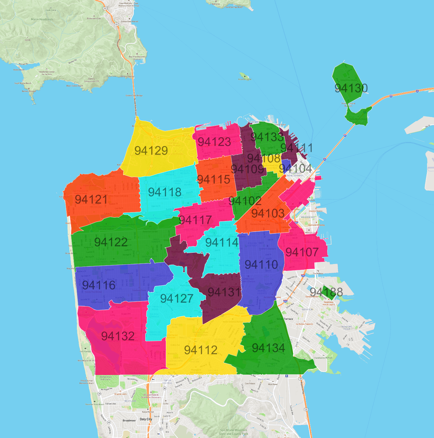
Zip Codes in San Francisco City and County
Discover all ZIP codes in San Francisco City and County, complete with an interactive map and a comprehensive table showing population, area size, and geographic boundaries for each postal code.
- We have found 25 zip codes in San Francisco City and County.
List of Zip Codes in San Francisco City and County
| Zip Code | Population | Area (km2) |
|---|---|---|
| 94112 | 80,133 | 8.644 |
| 94110 | 66,687 | 6.203 |
| 94122 | 57,369 | 8.521 |
| 94109 | 54,397 | 2.793 |
| 94121 | 42,987 | 6.558 |
| 94116 | 42,523 | 6.641 |
| 94134 | 40,142 | 6.706 |
| 94118 | 39,275 | 5.196 |
| 94117 | 37,575 | 3.302 |
| 94102 | 34,983 | 1.714 |
| 94114 | 33,627 | 3.587 |
| 94103 | 33,524 | 3.559 |
| 94115 | 32,715 | 2.944 |
| 94107 | 30,190 | 4.66 |
| 94131 | 27,809 | 5.288 |
| 94132 | 27,406 | 9.411 |
| 94133 | 24,753 | 1.703 |
| 94123 | 24,518 | 2.789 |
| 94127 | 20,710 | 4.84 |
| 94108 | 11,008 | 0.668 |
| 94111 | 4,553 | 0.855 |
| 94129 | 3,808 | 6.098 |
| 94130 | 2,829 | 2.231 |
| 94104 | 478 | 0.201 |
| 94188 | 0 | 0.226 |