Zip Codes in St. Louis
Discover all ZIP codes in St. Louis, complete with an interactive map and a comprehensive table showing population, area size, and geographic boundaries for each postal code.
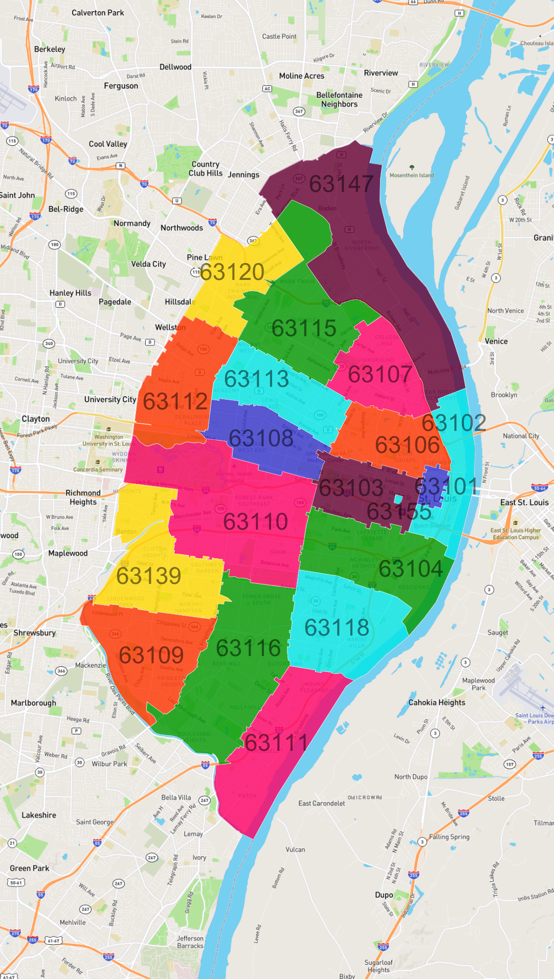
- We have found 19 zip codes in St. Louis.
List of Zip Codes in St. Louis
| Zip Code | Population | Area (km2) |
|---|---|---|
| 63116 | 42,470 | 14.001 |
| 63109 | 25,743 | 9.196 |
| 63118 | 25,645 | 9.475 |
| 63139 | 21,811 | 9.889 |
| 63108 | 20,692 | 5.808 |
| 63111 | 19,093 | 10.34 |
| 63104 | 18,701 | 9.529 |
| 63112 | 18,353 | 8.219 |
| 63110 | 17,725 | 17.017 |
| 63115 | 14,252 | 11.14 |
| 63113 | 11,610 | 6.682 |
| 63107 | 9,082 | 6.072 |
| 63103 | 8,927 | 5.691 |
| 63147 | 8,229 | 17.991 |
| 63106 | 7,742 | 5.774 |
| 63120 | 7,227 | 6.175 |
| 63102 | 3,004 | 5.18 |
| 63101 | 2,953 | 0.938 |
| 63155 | 0 | 0.058 |