Zip Codes in Tulsa
Discover all ZIP codes in Tulsa, complete with an interactive map and a comprehensive table showing population, area size, and geographic boundaries for each postal code.
- We have found 21 zip codes in Tulsa.
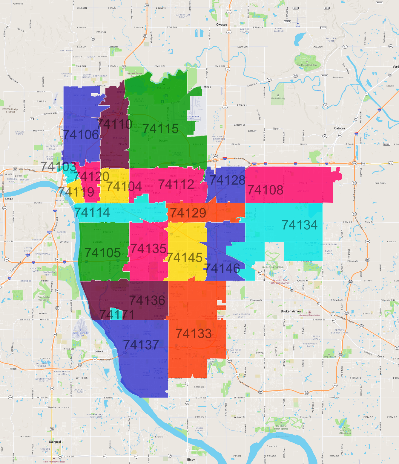
List of Zip Codes in Tulsa
| Zip Code | Population | Area (km2) |
|---|---|---|
| 74133 | 48,686 | 35.453 |
| 74136 | 31,682 | 21.106 |
| 74137 | 28,398 | 27.996 |
| 74105 | 27,249 | 19.619 |
| 74115 | 23,657 | 43.443 |
| 74134 | 22,856 | 32.389 |
| 74112 | 21,416 | 17.738 |
| 74135 | 19,737 | 15.922 |
| 74129 | 18,764 | 10.373 |
| 74145 | 17,955 | 15.429 |
| 74114 | 16,756 | 12.792 |
| 74146 | 16,133 | 13.327 |
| 74106 | 15,974 | 19.79 |
| 74110 | 15,185 | 15.232 |
| 74128 | 13,586 | 9.333 |
| 74104 | 12,434 | 7.02 |
| 74108 | 7,530 | 22.503 |
| 74120 | 5,065 | 5.456 |
| 74119 | 3,541 | 2.021 |
| 74103 | 2,419 | 1.693 |
| 74171 | 2,204 | 0.924 |