Neighbourhoods in Winston-Salem
List and Map of the Neighbourhoods in Winston-Salem
- We have found 73 neighbourhoods in Winston-Salem.
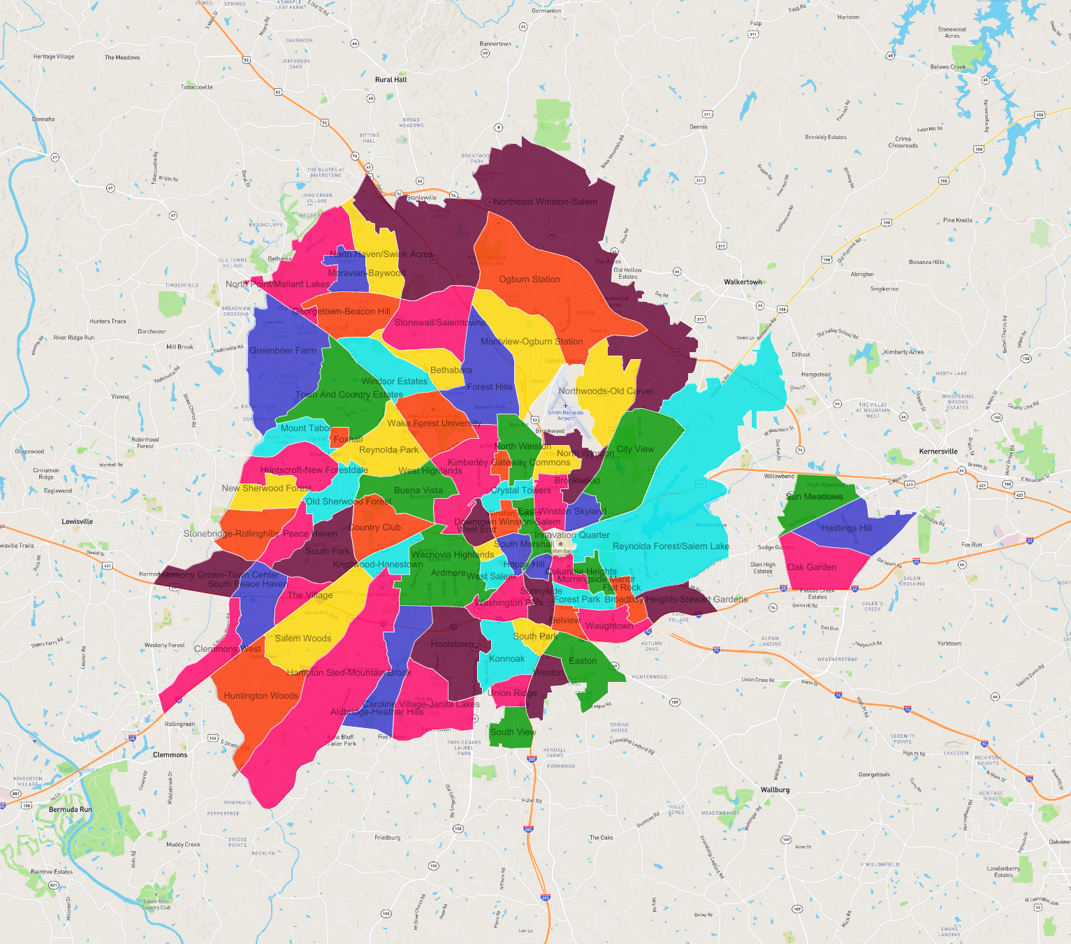
List of the Neighbourhoods in Winston-Salem
| Neighbourhood |
|---|
| Stonewall/Salemtowne |
| Northwoods-Old Carver |
| Country Club |
| Knollwood-Hanestown |
| Northeast Winston-Salem |
| Columbia Heights |
| West End |
| Windsor Estates |
| Hastings Hill |
| Sun Meadows |
| Harmony Grown-Town Center |
| Easton |
| Weston |
| Morningside Manor |
| Washington Park |
| West Highlands |
| Peace Haven |
| Ardmore |
| South Marshall |
| Reynolda Park |
| Foxhall |
| Caroline Village-Janita Lakes |
| Buena Vista |
| North Point/Mallard Lakes |
| Stonebridge-Rollinghills |
| Huntington Woods |
| Montview-Ogburn Station |
| Bethabara |
| North Winston |
| South Fork |
| Sunnyside |
| Huntscroft-New Forestdale |
| The Village |
| Reynolda Forest/Salem Lake |
| Crystal Towers |
| Brookwood |
| Konnoak |
| Moravian-Baywood |
| Aldbridge-Heather Hills |
| Salem Woods |
| Ogburn Station |
| North Winston |
| Hampton Sted-Mountain Brook |
| East Winston |
| Old Sherwood Forest |
| West Salem |
| Greenbrier Farm |
| Wachovia Highlands |
| City View |
| Town And Country Estates |
| Forest Park |
| Wake Forest University |
| Flat Rock |
| South Peace Haven |
| Mount Tabor |
| Skyland |
| Clemmons West |
| Georgetown-Beacon Hill |
| Waughtown |
| Union Ridge |
| South View |
| Hootstown |
| New Sherwood Forest |
| South Park |
| Happy Hill |
| Forest Hills |
| Broadbay Heights-Stewart Gardens |
| Oak Garden |
| Downtown Winston-Salem |
| Belview |
| Kimberley Gateway Commons |
| Innovation Quarter |
| North Haven/Swink Acres |